
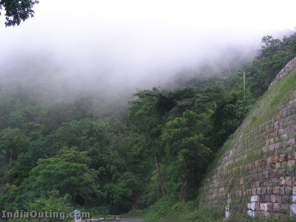
Unforgettable Udagamandalam, the ‘QUEEN OF HILLS’ is perched at an altitude of 7500 feet above sea level.
It is a land of picturesque picnic spots. Used to be popular summer and weekend getaway for the Britishers during the colonial days. . An added attraction for the tourists to Udagamandalam is the mountain train journey on a ratchet and pinion track which commences from Kallar, near Mettupalayam and wends its way through many hair-raising curves and fearful tunnels and chugs along beside deep ravines full of verdant vegetation, gurgling streams and tea gardens. This charming resort is ideally suited for a truly enchanting holiday, hunting the forests, fishing the streams, boating on the lake, hiking on the downs, meandering through lovely gardens, playing a game of golf, visiting settlements...
About Ooty:
Total Area: 36 sq kms
Altitude: 2240mts
Climate: Summer – Max. 25 C, Min. 10 C
Winter – Max. 21 C, min. 5 C
Season: April to June and September to November.
Rainfall: 121cms
Languages: Badaga, Tamil, Kannada, Hindi,Malayam and English.
Clothing: Heavy Woollen in winter
Light Woollen in summer
Route Map:
How to reach:
By Air:
The nearest airport is in Coimbatore Coimbatore from Chennai, Kozhikode, Bangalore Coimbatore
By Train:
Ooty is connected to Mettupalayam by the famous Nilgiri Mountain Railway. Coimbatore
By Road:
Ooty is well connected by good roads. It is 535 km from Chennai. (Via Salem ) 89 km from Coimbatore Mysore
There is regular bus service from Bangalore , Mysore , Coimbatore , Calicut
Interesting places in Ooty:
Botanical Garden:

The Botanical Garden is maintained by the Horticulture Department of the Government of Tamil Nadu and has a very wide variety of plants that include different types of roses, imported shrubs, rare flowering plants, eucalyptus trees, several old trees and even a fossilized tree trunk that is 20 million years old. There is also a beautiful Italian floral garden and for those who simply want to relax, there's always the green carpet of the well-maintained lawns. The "Summer Festivals" is held each year during the month of May in the Botanical Garden and is an added attraction for tourists. The Flower Show is the pride of the festival. Cultural programmes are organized for those interested in traditional classical arts. Adventure spots like trekking also form part of the festival.

Rose Garden:

Wenlock Downs:

The Government Museum
The Government Museum Mysore Road
Admission is Free.
Timings: 10.00 a.m to 1.00 p.m and 2.00 p.m to 5.00 p.m.
Holiday : Friday, Second Saturday and National Holidays.
Admission is Free.
Timings: 10.00 a.m to 1.00 p.m and 2.00 p.m to 5.00 p.m.

This highest peak (2638 m) of Nilgiris is located just 10 km from Udagamandalam. It is easily accessible by road on a clear day and offers beautiful vistas of the Nilgiri hill ranges. The peak has a telescope house urn by the TTDC.

Law’s Falls:
The falls are located near the confluence of Kateri and Coonoor rivers on the Coonoor- Mettupalayam ghat road.
Sim’s Park:

Kotagiri:
It is 31 Kms. from Udhagamandalam. The climate is very salubrious which 6503 feet above sea level is. Kotagiri is shielded by the Doddabeta ranges which receive much of its rain from North West
Kodanadu view point:

St. Catherine Water Falls:
From Dolphin's Nose of Coonoor one can have a magnificent view of St. Catherine Water falls which is about 250 feet height. But it can be reached from Kotagiri at a distance of 8 Kms. To reach the top of the hills tourist should take a diversion at Aravenu on Kotagiri - Mettupalayam road.
Gudalur:
Gudalur:
It is the Gateway to Nilgiris from Kerala and Karnataka. Udhagamandalam, Coonoor and Kotagiri lie in the upper plateau of Nilgiris and Gudalur lies in the lower plateau. Udhagamandalam to Calicut
Frog hill view point:
It is 14 Kms. from Gudalur on the way to Udhagamandalam-/ Gudalur road. From here one can see gigantic Frog shape of a hill view.
Needle point rock view:

Numbalkottah:
8 Kms. from Gudalur. A shrine of Battarayaswamy (Lord of the hunts) with sub-shrine built in Kerala style is here. Wynad scenes are visible from here.
Nellakotta: It is 15 Kms. from Gudalur. A dilapidated fort is there.
Nelliyalayam: 20 Kms. from Gudalur. A few ruins of historical dynasty can be seen here.
Cherambadi: 35 Kms. from Gudalur. It is extreme western corner which has plantations and mica mines. Sultan battery is very near.
Hanging Bridges: Located on the way to Mudhumalai wildlife sanctuary. It is 14 Kms. from Gudalur
The other tourist places are Siva Temple
Where to stay:
The Willow Hill
Nahar's Nilgiris Hotel
Nahar's Residency Hotel
Hotel Lake View
Moti Manor
Hotel Darshan
Hotel Silver Oak
Hotel Sunshine
Preethi Classic Towers
Ooty Gate
Holiday Inn Gem Park
Hotel Sapphire Grand
Homestays
Where to Eat:
Blue hills
Chandan Vihar
Tandoor Mahal
Ooty Coffee House
Chinkos Chinese Restaurant
Hills Palace
Similar places of Interest:


This comment has been removed by the author.
ReplyDeleteThis comment has been removed by the author.
ReplyDeleteThis comment has been removed by the author.
ReplyDeleteThis comment has been removed by the author.
ReplyDelete