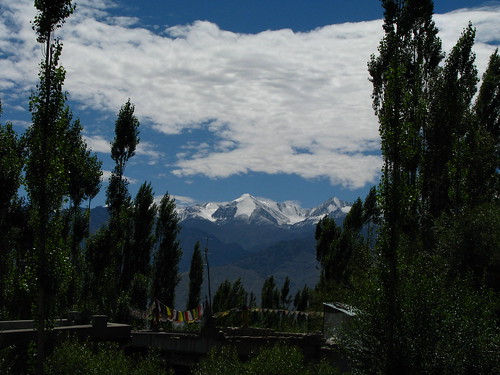
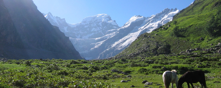
The beautiful Kashmir valley looks like a paradise on earth. The valley is so beautiful that you will fall in love with it at the first sight itself. Infact, the charm and magnificence of Kashmir are beyond the scope of mere words. Kashmir filled with natural surrounding gives you a perfect place to beat the heat and dust of the summer months. With steep slopes, deep gorges and snow filled mountains throughout the year, Kashmir is a favorite destination for honeymoon makers.
The valley is distinctively marked by breath-taking lakes, fresh water streams, luscious fruits, magnificent forests, mighty mountains and lush meadows which makes it a paradise on Earth. The mountain-downs or “margs” are numerous on the tops of the hill ranges prominent being Gulmarg, Sonamarg, Yousmarg etc.
Famous valleys of Kashmir include: LidderValley, SindhValley, LolabValley, BangusValley, DachigamValley, GulmargValley, GurezValley, Yousmarg Valley etc.
Location:
Carved tectonically, the valley of Kashmir is a longitudinal depression in the great north-western Himalayan range, situated at an altitude of 1590 mtrs (5209) feet.
By Air Srinagar airport is approximately 14 km from the city. There are daily flights to Srinagar, operated by Indian Airlines (from Delhi, Mumbai and Jammu) and Jet Airways (from Delhi and Jammu).
By Rail Jammu Tawi, approximately 305 km far, is the nearest railhead for Srinagar. Trains from Delhi, Calcutta, Pune, Mumbai and other cities arrive at this station only. During holiday season, when there is a heavy rush for Kashmir, additional trains operate for and from this station.
By Road National Highway 1-A is the main highway connecting Srinagar with Jammu. J&K State Road Transport Corporation (SRTC) as well as a number of private Super deluxe, A-class and B-class busses operate to and from the state. Private taxis are also available for traveling to Kashmir.
Interesting Tourist Places:
Gulmarg: Gulmarg (Meadow of Flowers) is situated in the Baramulla district of Kashmir. It is 56 Kms southwest of the capital city Srinagar. The picturesque beauty and location of Gulmarg, make it one of the popular hill stations in the country. Dotted with colourful bluebells, daisies, forget-me-nots and buttercups, Gulmarg looks more beautiful during springs.
Pahalgam: The Valley of Shepherds: Situated at the confluence of the streams flowing from SheshnagLake and the Lidder river, Pahalgam (2,130 m) was once a humble shepherd's village with breathtaking views. Now it is Kashmir's premier resort, cool even during the height of summer when the maximum temperature does not exceed 250C.
Sonamarg: The Meadow of Gold: It has, as its backdrop, snowy mountains against a cerulean sky. The SindhRiver that meanders through the valley abounds with trout andmahaseer. Ponies can be hired for the trip up to Thajiwasglacier, which is a major local attraction during the summer months
DalLake The sweet water lake is the Jewel in the crown of the Kashmir and has been the inspiration for poets and a major attraction for the tourists. The 6.4 Km long and 4 Km wide lake is divided into three parts - Gagri bal, Lokut Dal and Bod Dal. DalLake is known worldwide for Shikaras and Houseboats. Within the lake, two small islands called as Sona Lank (GoldIsland) and Rupa Lank (SilverIsland) are famous picnic spots. The tourists can enjoy Shikara rides, Kayaking, Canoeing and Angling here.
Srinagar:Srinagar is located in the heart of the Kashmir valley at an altitude of 1,730 m(1530 feet) above sea level, spread on both sides of the river Jhelum. The Dal and Nagin lakes enhance its picturesque setting, while the changing play of the seasons and the salubrious climate ensures that the city is equally attractive to visitors around the year.
Amarnath: Situated 145 Kms east of Srinagar, Amarnath is considered to be one of the major Hindu Dhams. Amarnath is known for an ice Siva-linga, which changes its size with the seasons. The linga becomes 6 ft high on the full moon day. The annual festival of Amarnath takes place at this cave temple during July-August on the full moon day.
MughalGardens Situated on the banks of the DalLake, in the backdrop of the majestic hills, these beautiful gardens commands a magnificent view of the lake. . The Mughal gardens include Shalimar Bagh, Nishat Bagh and Chashmeshahi Bagh. HarwanLake Set amidst the lofty Mahadeo hills, the clean and pure water lakeHarwan, offers the beautiful view of the surroundings. The Lake is the source of water for the huge garden lined with flower beds and high Chinar trees. The vast green lawns of the HarwanLake make its ideal for picnics and excursions.
Katra: Katra serves as the base camp for pilgrims who visit Vaishno Devi. one should not miss the opportunity to walk through the main bazaar (market) for buying (do not forget/hesitate to negotiate a bit) souvenirs, dryfruits, woolen garments, hosiery, leather jackets, etc.
Vaishno Devi: The holy shrine of Mata Vaishno Devi is situated at a distance of fourteen kilometers from Katra. From Katra, one has to trek uphill to reach the destined shrine. Located a top MountTrikuta, the Vaishno Devi temple is considered to be one of the holiest places in India. There is also an influx of foreign tourists, apart from the domestic pilgrims turning out in hundreds, to get a darshan of the holy Mata. Zest for the unknown attracts the adventurous foreigners, since there’s a lot unexplained phenomenon and myths that surround VaishnoDeviTemple. For instance the natural rock formation or pindies, as they are popularly called, leaves one dumbfounded. The rock forms of Laxmi, Kali, and Saraswati are the only idols that one can find in the shrine. Leh and Ladakh:
Ladakh, a part of Jammu & Kashmir state in north of India, consists of two districts, Leh and Kargil. Leh with and area of 45110 sq km makes it the largest district in India in terms of area. The district is bound by Pakistan occupied Kashmir in the west and China in the north and eastern part and Lahaul Spiti of Himachal Pradesh in Southeast. It is at a distance of 434 Km from Srinagar and 474 km from Manali. Where to Stay:
The holy MountKailash is situated in the western Tibetan plateau in the northernmost region of the Himalayas. Also referred to as MountMeru and Kang Rinpoche, or snow jewel, MountKailash is a 22,028 ft high peak known for being the abode of Shiva. Hindus perform a 'parikrama' or walk around the 32-mile circumference of MountKailash, an act that is believed to wipe away all sins. Four holy rivers originate from MountKailash: the Indus, the Brahamputra, the Karnali and the Sutlej
Kailash Mansarovar is in the western part of the Tibetan Himalayas at an altitude of 6,714 m. The Kailash Mansarovar yatra or journey takes around 30 days of combined travel by bus or jeep, and then by foot. The journey is along the fixed route chosen by the Indian and Tibetan governments and bookings have to be made with the Kumaon Mandal Vikas Nigam. Another way is to fly to Kathmandu, and then drive to Mansarovar - this is a relatively easy route. A quick, but very expensive way of doing the trip is to book a 9 or 12 day helicopter tour...
About MansarovarLake
Travel 18 miles southeast of Kailash, and you arrive at the placid blue circular LakeMansarovar, also known as Tso Rinpoche or 'precious lake' in Tibetan. Bathing in the freezing cold water of the lake which is said to contain miraculous powers is considered to be of massive spiritual benefit.
About the Yatra
The duration of the Yatra is 26 days. In addition, Yatris will need to spend 4 days in New Delhi to obtain visas, undergo a comprehensive medical examination and complete other formalities. This year, 16 batches each consisting of a maximum of 60 pilgrims will take part in the Yatra. The first batch is expected to depart from New Delhi in the last week of May/first week of June and continue till the end of September 2008.
Cost of Travel
Applicants should ensure that they possess an Indian Passport. The cost of the Yatra will include Rs. 19,250 to be paid to Kumaon Mandal Vikas Nigam (KMVN), Rs. 1,950 to be paid to ITBP for medical examination / tests at Delhi, and US$ 700 to be paid to the Chinese side, besides additional expenditure on equipment, clothing, food, baggage, ponies, etc.
An Arduous Yatra
The Indian Mountaineering Foundation has recognized the Kailash Manasarovar Yatra as a trekking expedition with an element of life risk involved. The Yatra is extremely arduous - much more than Vaishnodevi or Amarnath Yatra, and involves trekking at altitudes as high as 19,500 feet, under hostile conditions, in extreme cold and on rugged terrain, and may prove hazardous for those who are not physically fit.
There are 3 ways to reach MountKailash from India. 1) By road from India. The Government of India organises tours to LakeManasarovar. This is a 30 day trek but the disadvantage is that it has to be booked well in advance and there is no certainty that one can go despite being in physical shape, because the number of seats is limited. About 400 people make it from the 6000 that apply each year.
2) By air to Kathmandu and from there by road to LakeManasarovar at the base of MountKailash. Nepal Airways has flights from Mumbai to Kathmandu. They are not particularly renowned for reliability. Flights are often delayed or cancelled. Most travellers prefer to take Indian Airlines from Delhi. This has become the most popular route.
3) Helicopter tours of Kailash for those who are short of time or cannot take the rigours of a grueling high altitude road journey. The tour uses fixed wing aircraft for the flight from Kathmandu to Nepalganj and from there to Simikot. From Simikot a helicopter flies to Hilsa. Landcruisers are then used to reach Manasarovar via Lhasa.
Places of Interest:
SacredLake Manasarovar (4588m) is located in the Western Tibet between Mt.Kailash (6714 m) and GurlaMandhataRange (Memo Nani, 7694m). For Hindus, LakeManasarovar floats beneath the shadow of holy Kailash and was created to show the omnipotence of Brahma's mind (manas). Tibetans know it as Maphan Tso, 'the UnconquerableLake'. For many, this is holiest lake in Asia.
Parikrama:
Parikrama or circumambulation of the Kailas Parvat encompasses walking around the 32 miles with great devotion. The Tibetans used the term Kora for the clockwise circumambulation. It is interesting to note that whatever be the name, all the devotees does the walk with the same belief that it would alleviate them from all their sins and proffer them with the much awaited salvation.
Gauri Kund:
This water body is described as the lake of compassion in the Shiva Purana, which unfurls the funny but touching story of the elephant headed god. A steep descent from the Dolma Pass will fetch the devotee to this lovely lake that lies at an altitude of 5608 metersThis lake is popularly called as the Parvati Sarovar since it was here that Goddess Parvati breathed life into the image of Ganesh, which she had created from the soap foam on her body. Though difficult to get in, this lake offers the beholder some of the awe inspiring vistas of Himalayas. One would get the beautiful reflection of the Chhota Kailash peak in its surface and it is undeniably awesome and would definitely took the breath of the on looker.
RAkshas Tal:
Rakshas Tal at a height of 4515 meters bears a legend associated with the demon King Ravana. Rakshas tal and Manasarovar are considered as sister lakes and are divided by a narrow hill. Rakshas Tal appears dull and grumpy and it hence it is often linked with the forces of darkness. Apart from its mythological significance, Rakshas Tal offers mind blowing sites of two beautiful islands.
Health Fitness:
Fitness is crucial. It is advisable to get a medical examination and check with your regular doctor before you plan this trip. Anyone suffering from back problems may find the long drives over bumpy roads difficult. People suffering from asthma or any kind of dust allergy are forewarned that the amount of dust on the road necessitates wearing a mask. Anyone with serious health problems are advised to get a medical check up done and strictly go by the advise of their doctor. Apart from that, it is a good idea to prepare in advance with brisk walking, and some regimen of exercise or preferably yoga asanas and pranayama. While the average age of yatris is 45 plus, fitness cannot be over-rated. Eventually, for most people the Kailash parikrama is an act of faith.
Kailash-Manasarovar Yatra - Some Tips
1. During electric storms, don't point upwards metallic objects like wireless aerials which can attract lightning. Also, keep away from conical rocks. Don't take shelter under a tree. Don't remain on the top of hills. Open space is safer. One can even sit down on a non-coducting sheet etc. if one has. 2. Wear more thin clothes, instead of one or two thick clothes. Have a wind cheater. 3. Practice walking with trekking shoes on before the yatra begins. Keep the shoes inside the sleeping bag during yatra nights, otherwise they may freeze. 4. Wear two socks: One woolen and the other cotton. 5. Feet must be dry. Use dusting powder. Wet shoes cause blisters. 6. Extremities like hands and feet must be protected against extreme cold. Exposure of extremities can lead to high altitude pulmonary oedema. 7. Take lots of water and fluids. Body needs a lot of energy. 8. Wear good sunglasses to protect eyes against snow blindness. 9. Apply sun cream or calamine lotion on exposed parts to avoid sunburn. 10. Cuts, blisters and ulcers need proper, urgent treatment. 11. Keep moving fingers, toes and facial muscles. 12. Stay close together to remain warm. 13. Begin trekking early in the morning. 14. Walk steady and always with a companion. 15. High altitudes kill appetite and can cause loose motions also. Do not neglect food. 16. Don't get separated from the group. 17. Don't sleep with the boots on. 18. Don't overexert.
Himachal Pradesh has beautiful natural sceneries and architectures. One the best well known is its hill station of Shimla. Shimla has been the summer capital of the British Raj and was called as the 'Queen of the Hill Stations'. Location of Shimla is at an altitude of 2159 metres and therefore it is always cool during the summers
Shimla covers an area of 18 sq. km on a crescent shaped ridge. It includes many hills like the Jakhu, Prospect Hill, Observatory Hill, Elysium Hill and Summer Hill. The city is surrounded by forests of pine, deodar, oak and rhododendron. It is well connected by rail, road and air. Shimla is connected to Kalka by train which takes 6 hours. There is also an overnight train from Delhi which reaches Kalka early morning. From here you can catch the connecting narrow gauge train from here to Shimla...
Season:
Mid - April to Mid - July, Mid - September to Late October and Mid - December to Mid - January. The best time to visit is Mid - September to Late November
By Air JubbarhattiAirport of Shimla, located at the distance of 23 kms from downtown, is the one that connects it with the rest of the country by air. Shimla has regular flights to all the key cities in and around Himachal, like Chandigarh, Kullu, and Delhi. In fact, it has daily flights to Delhi and Kullu. Jagson Airlines also operates a bi-weekly flight on Delhi-Shimla-Kullu-Gaggal route.
By Rail Kalka, at the distance of 96 km, forms the nearest railhead from Shimla. The duration of journey from Kalka to Shimla, in the toy train, is around six hrs. Frequency of trains between these two cities is regular. You can take Kalka Mail from Delhi that takes you to Kalka early in the morning and from there, one can catch connecting train, on the splendid narrow-gauge track, to Shimla.
By Road Shimla is well connected by road to all the major towns of state and other major cities of country. Kalka (80 Kms), Chandigarh (119 Kms), Ambala (166 Kms), Delhi (370 kms), Agra (568 Kms), Amritsar (342 Kms) are the major cities tourists can board buses from. Deluxe as well as ordinary buses are also available from all these places. One can hire taxis too.
Places of Interest:
Chadwick Falls:Are only really worth visiting during or just after the monsoons (July to October). The falls are 7 km from Shimla and can be reached via Summer Hill.
Annandale Located three kilometer from downtown, in the open grounds, and near to the ridge, Annandale is a major tourist attraction nearby Shimla. Being a peaceful and serene place, it is perfect for picnic. Annandale also has cricket and polo grounds and gymkhana.
Jakhoo Hill(2.5km) At 2455m, this is the town's highest peak and a vantage point for Shimla famous views. The summits is crowned with a temple dedicated to Lord Hanuman. The hills is full of paths and narrow roads which are enjoyable walks.
Kufri (16km) At 2501m, this is famous for itswide views and ski slopes.An enjoyable walk leads up to the MahasuPeak. At Kufri, Himachal Tourism runs the Café Lalit.
Tattapani : It is 51 km from Shimla and well known for hot sulfurous springs. One can enjoy fishing and playing in the water
Wild Flower Hall:Wild flower hall issituated at an altitude of 2,498 m and 13 km from Shimla on Hindustan-Tibet Road. Nestling among thick flora and fauna, the Wild Flower Hall commands a breathtaking view of the snows.
Mashobra (12km) At 2149m, this beautiful subrub is surrounded by a thick forests. From here a track down to Sipur which is an exquisite gladed shaded by anicient deadors trees. There are old temples on a side and a fairs is held every April.
Sanjauli Sanjauli is a place that offers tranquility and quietness to the travelers. It is the perfect tourist destination for those who are really tired of the metro’s life and its terrific pollution and want to take a restful break. The place is located in serene valley and offers an awesome vacation.
Chail Overlooking the SutlejRiver and located on a wooded spur, Chail is attractive tourist destination. The idyllicresort, set amidst scented forests of pine and deodar, is visited by a large number of tourists every year, especially those coming on a honeymoon.
Naldehra : Naldehra, is situated at an altitude of 6706 feet and is 25 km from Shimla on Shimla- Tattapani road. Naldehra houses the oldest and the highest golf course in India. It is a famous picnic spot and one can have leisure pine lined forest walks and horse rides. Its beauty has
attracted the film industry and this place has featured in many Hindi movies.





 Vaishno Devi: The holy shrine of Mata Vaishno Devi is situated at a distance of fourteen kilometers from Katra. From Katra, one has to trek uphill to reach the destined shrine. Located a top