Friday, November 6, 2009

Goa - Tourism


Goa -  Tourism

Goa, a tiny emerald land, with its natural scenic beauty, attractive beaches and temples famous for its architecture, feasts and festivals and above all hospitable people with a rich cultural milieu, has an ideal tourist profile Get swept away by the spectacular sunrises and sunsets, sunbathe and stroll along it's wide and serene beaches, Goa is the place to spend a much needed holiday.


Location:
 Goa, a tiny emerald land of 3,702 Sq.Kms. on the west coast of India. Located in the Sahayadri Range in the Western Ghats with the Arabian Sea on its west,

Season:
The best time for visiting Goa is during the months of October to March. This is the ideal time, as the monsoons cross over to the Indian mainland after pouring on the land of Goa.

Route Map:
View Larger Map

Getting There:

On Tracks:

 Goa is connected with Mumbai, Delhi, Pune, Secunderabad, Tirupati via Londa junction on the Mirage-Bangalore sector of south central railway, and to Mumbai, and Mangalore on the Konkan Railway Corporation section. Convenient stations are Margao/Vasco and Karmali.
Fly away:
The only airport in Goa is the Dabolim Airport, which is though a military airport but civilian flights also operate from here.The airport also handles apart from regular flights , chartered flights as well from countries like UK and Germany.
Indian Airlines has direct daily flights from Delhi and Mumbai to Goa. Air India also operates from Goa.The airport is owned by the Indian Navy. Major airline operators such as Indian Airlines
On Wheels: There are interstate bus services to Mumbai (16 hrs), Bangalore, Mangalore, Londa, Pune, Hospet, Hampi and Hubli.
On Ship:    Ship services between Bombay and Goa organised by Damania. 


Prime Attractions of Goa:


Vasco-da-Gama: It is 30 kms. from Panaji. A modem, well laid out city close to Mormugs Harbour, has beautiful and extensive avenues. The air terminus of Goa at Dabolim lies on the outskirts of the city. It is also the railway terminus for passenger service in the South Central Railway.

Panaji: The capital of Goa and headquarters of North Goa District, a small a charming city on the left bank of silvery Mandovi River, with beautiful red-roofed houses, built in Latin style, also boasts of many modern houses, well laid garden, statues and avenue's lined with Gulmohar, Acassia and other trees. Enchantit panorama unfolds from atop Altinho (Hill Top).
Mapusa: It is 13 Kms. from Panaji. The capital of Bardez Taluka, on the national highway, is the cross roads of the network of highways covering whole of Northern Goa. Weekly fair on Friday, is held at the modem streamlined market, attended by large crowds.

Wildlife in Goa
The rugged western ghats make it an ideal haven for many species of birds and animals and also provide a corridor for migration. The western ghats called the Sahyadris in Goa, extend for a total of 600kms in Goa of their total length of 3702 kms.

Dr. Salim Ali Bird Sanctuary: This is Goa's only bird sanctuary, 1.8 Sq Km in area. A variety of local and migratory birds can be found on this island.

Alorna Fort
The Alorna fort is situated in the village of Alorna which is about 30 km from Mapusa and 10 km east off NH 17 from Malpem in Pernem

Ancestral Goa Museum / Big Foot
The Ancestral Goa museum/ exhibition is situated in the small village of Loutolim which is about 10 km from Margao and 25 km from Panaji. The musuem is also known as big foot.


Arvalam Waterfalls
The Arvalem or Harvalem waterfalls, which cascades down from the mountains, from a height of 50 metres, is one of the most awe-amazing spots. It is situated at about 2 km from the small town of Sanquelim
Boca De Vaca Spring
Situated next to the Mahalaxmi temple, the Boca de Vaca spring is one of the two springs that exist in Panaji Goa.

Carambolim Lake in Goa
The Carambolim Lake is situated approx 2 kms southeast of Old Goa in the Tiswadi taluka. It is excellent place of birding in Goa that supports a large population of herbivorous birds
Chorao Island
The Tiswadi island of Chorao is situated 5 kms from Panaji. The earliest settlers of the island were 10 families of the Goud Saraswat Brahmins

Divar Island
The beautiful Divar Island that is rarely visited is situated across the Mandovi River from Old Goa. A ferry connects the southern end of the island with Old Goa
Dudhsagar Waterfall
The Dudh Sagar waterfall is situated in the Indian state of Goa in Sanguem taluka. It is located 60 kms from the capital city of Panaji and is well connected with Panjim and Margao


Kuskem Waterfall
The Kuskem waterfall is located in the Canacona taluka in South Goa. It can be visited whilst on the way to the Cotigao Wildlife Sanctuary

Beaches of Goa:


The prime tourist attractions in Goa are, no doubt, its sunbathed golden beaches. Some of important beaches of Goa


Places to Eat:
  • Villa Saligoa

  • China Highway

  • Hotel La Paz Gardens

  • Banjara

  • Margoa

  • Peter's

  • Panjim Latenight Eatout


 Accommodation and Lodging:


Travel Tips:

·         Before setting out on a sightseeing tour make it a point to carry bottled mineral water with you.
·         You might be a sucker for roadside food but check out that proper hygiene has been maintained in the roadside stalls.
·         For a day out in the beaches, use sunglasses and sunscreen lotions.
·         Maintain individual hygiene and regularly wash hands with soap and water.
·         Buy over the counter medicines only from authorized pharmacies.
·         Always carry a bag of medicines for common ailments such as common cold and an upset stomach.
·         Before setting out on a sightseeing tour make it a point to carry bottled mineral water with you.
·         You might be a sucker for roadside food but check out that proper hygiene has been maintained in the roadside stalls.
·         For a day out in the beaches, use sunglasses and sunscreen lotions.
·         Maintain individual hygiene and regularly wash hands with soap and water.
·         Buy over the counter medicines only from authorized pharmacies.
 

Water Sports in Goa


 Other Travel Destinations:


Sunday, November 1, 2009

Mount Abu - Rajasthan


Mount Abu :   Rajasthan


  Oasis In The Desert

Mount Abu is the highest peak in the Aravalli Range of Rajasthan, nestling in the south of Sirohi district in Rajasthan.
The nearest city to Mount Abu is Udaipur, which is lying 185 km far.
Mount Abu is renowned as the "oasis in the desert" as its tallness are abode to shallow rivers, blue lakes, gurgling waterfalls and green vegetation.  Mount Abu is popular spot for newlyweds and nature lovers. One can feel the air packed atmosphere on its streets and the famous places of attractions


Important Information:
                        Altitude:  1219 mtrs.

Best Season: March – June and Sept - December

Climate: Summer   Mean Max. 38.8 'C   Mean ,  Mean Min. 23.3 'C
                 Winter     Winter Mean Max. 28.3 'C ,  Mean Min. 11.6 'C


Clothing: Summer light tropical or light Winter Woolen. 

Route Map:
View Larger Map

Getting There:
Fly away:
Udaipur, located some 190 km and Ahmedabad, located around 187 km from Mount Abu are the nearest airports. Ahmedabad is a large and better-connected airport in comparison to Udaipur. There are scheduled flights of the government operated as well as privately owned airlines from these airports.

On tracks:
There are direct trains to Abu Road Station (27 km away from Mount Abu) from Delhi, Jodhpur and Agra. A fast train takes four hours between Ahmedabad in Gujarat and Abu Road.

On wheels:
Regular buses connect Abu Road to Mount Abu. The journey takes about an hour. Taxis and jeeps are also available to take you to Mount Abu. Direct buses also connect Mount Abu with Udaipur and Ahmedabad.

Local Transport
Buses ply regularly from Mount Abu to Dilwara and Acgalgarg, Taxis are easily available for any destination.


Mount Abu Tourist Attractions:

Nakhi Lake


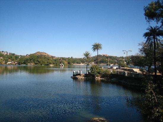
Legend has that this small lake, was scooped out by a god using only his nails(or nakh).The lake is surrounded by hills, parks and strange rock formations.The 14th Century Raghunaht temple stands beside the lake.Several Maharajas built lavish summer houses around the Nakki lake, and the maharaja of Jaipur's formar summer palace is perched on a hill onlooking the water.


Guru Shikhar (15 km): The highest peak on the mount (1722 mts. Above the sea level) allows a bird’s eye view of the sylvan surroundings of Mt. Abu. A small Shaivite shrine and a temple of Dattatreya standing on the shikhar are worth a visit.

Sunset Point   This place is perched atop the rocky portion of Mount Abu. The height and the strategic location serves as a favorite vantage point for the people and tourists to encamp themselves on the scattered rocks and watch the spectacle of Sunrises and Sunsets. 

Gaumukh Temple:

A natural spring flowing through a sculpted cow’s head gives the shrine its name. The famous ‘yagna’ of sage Vashishtha was performed here. A beautifully sculpted hill temple of Arbuada – the mighty serpent stands against the beautiful backdrop. Nearby is the magnificient marble image of Nandi, the celestial bull rescued by Arbuada.
 Trevor’s Tank (5 km): Named after the British engineer who constructed it, Trevor’s Tank is a delight for birdwatchers with densely wooded hills that are a haven to pigeons, peacocks and partridges.
Achalgarh (8 km): An impressive fort with some beautiful jain temples enclosed within. Among the noteworthy temples are Achaleswar Mahadev Temple (1412 A.D.) and Kantinath Jain Temple (1513 A.D.) . The latter has gold plated image. Mandakini Kund and a sculpture of Parmar Dharavarsh are situated close to the Achaleswar Mahadev Temple. The Fort was built in the 14th century A.D. by Rana Kumbha and is approachable by a motorable road.

 .Dilwara:   is a key Indian Archeological site, nestled in the rocky and sylvan surroundings of Mount Abu. These beautifully carved temples built between 11th and 13th century A.D. are sheer elegance in marble, dedicated to the jain Tirthankaras. It is a superb example of temple architecture.The central shrine has an image of Rishabhdev and large courtyard with 52 small shrines,each housing a beautiful statue of thirthankaras with 48 elegantly carved
Adhar Devi Temple
Other attraction include Adhar Devi Temple, which is located 3 km in the north of town. This ancient Durga temple is chiselled out of a huge rock, which is reached by a flight of 365 stairs. It is one of the most believed holiest grounds for tourists and pilgrims across India. The temple allows panoramic views over the old mountain valley of Mount Abu.
 
Toad Rock:    Toad Rock is a mammoth rock structure in Mount Abu hanging over the south of calm and cool Nakki Lake.


Brahma Kumaris Spiritual University and Museum The university's stated aim is the establishment of universal peace through the impartation of spiritual knowledge and training of easy raja yoga meditation. To attend one of these residential courses, contact your local branch and arrange things in advance. There is no charge- the organization is entirely supported by donations, as is the accommodation.
Mount Abu Wildlife Sanctuary
Mount Abu Wildlife Sanctuary is located some 8 km northeast of Mount Abu and spreads over an area of about 290 sq km. The sanctuary is home to a number of wild animals, birds, trees and herbs. Panthers, wild boars, and bears can be seen roaming about in this small but beautiful sanctuary


The Aravalli Hills
This could be a daylong trekking adventure while visiting this granite hill range, the tailpiece of the Aravalli mountain range. The mountain covered with thick shrubs also gives a panoramic view of the area nearby. From Mount Abu, it is a daylong trip, which gives the traveller a chance to see the date palms and thorny acacias that abound in this region.


Shri Raghunathji Temple
Situated near the ‘Nakki’ lake is the temple dedicated to Shri Raghunathji with a beautiful image of the deity that was placed here in 14th century A.D. by Shri Ramanand the famous Hindu preacher.


Accommodations:


·  Kesar Bhawan Palace


Restaurants  of Mount-Abu
  Handi Restaurant (Hotel Hilltone)
▪  Mayur (Hotel Hillock)
 RTDC Restaurant (Hotel Shikhar)
▪  Dawat Restaurant
 Kanak Dining hall
  Madras Cafe
 Nakki Lake Sarovar
▪  Tekshila


Where To Shop in Mount Abu


Curious in marble, sandalwood and sandstone can be bought from the shops around Nakki Lake. Kota sarees, banglesand linen with sanganeri prints are also available.
Rajasthali- famous for Rajasthani Handicrafts, Khadi Bhandar- famous for metal, stone, wooden and clothing, Rajasthan Emporium- famous for Rajasthani handicrafts

Adventures in Mount Abu:


     Trekking
     Village Tour
     Camping
     Adventure
     Horse Safari
     Eco Tourism
     Parasailing
     Bike Rental


Rajasthan city guide » JaipurJodhpurJaisalmerUdaipurBikanerAjmerMount Abu .BharatpurRanthambhore


Wednesday, October 14, 2009

Mussoorie - Uttaranjal


MUSSOORIE    -   UTTARANJAL

Popularly known as the Queen of Hills, this charming hill station, 34 kms from Dehradun is situated at an altitude of 2003 mts in the Garhwal hills. above sea-level. Mussoorie is one the beautiful hill stations in India and the most frequently visited. It provides excellent respite to people who want relief from the hot sultry conditions of the plains, especially since it is close enough to the capital to make just weekend trip. Also, major Hindu pilgrimage sites like Kedarnath, Badrinath, Gangotri, Yamunotri, Haridwar, Rishikesh are not far from this place.


Best Season:
April to June and again during September to November

Route Map:
View Larger Map


Getting There:
Air :
The nearest Airport to Mussoorie is 60-kms away from the place. The airport is called Jollygrant Airport but there are no regular flights to this place.

Rail:
Mussoorie does not have a direct rail link. Dehradun Railway station serves for Mussoorie too. This station is linked which Superfast trains to other major cities in country.

Road:
From Dehradun one can hire a taxi or take a bus to Mussoorie. The queen of hill stations is well connected with roads with other major cities. There are regular bus services from various metros and other tourist destinations in Uttaranchal as well as from out side the state. Bus services are provided by State transports. There are conducted tours to Mussoorie too.


Sightseeing in Mussoorie:


Kempty Fall
15 kms from Mussoorie on the Yamunotri Road having an altitude of 4500 ft. It has the distinction of being the biggest and prettiest waterfall located in a beautiful valley and is surrounded by high mountains. Bath at the foot of the falls is refresshing and enjoyabled for children and adults alike.


MussoorieLake
 A newly developed picnic spot, situated on Mussoorie- Dehradun road and is about 6 kms from Mussoorie. It is a delightful spot. Pedal boats are availble. It commands an enchanting view of Doon Valley and nearby villages.


Gun Hill
One can enjoy a thrilling ropeway ride to Gun Hill, the second highest peak of Mussoorie(2122 mts). The peak offers a panoramic view of the Himalayan ranges.

Camel’s Back Road:

It starts from Kulri Bazar near Rink Hall and ends at Library Bazar covering a total distance of about 3 kms. The main charm of this froad is horse riding and wlking. Sunset view of the Himalayas is superb. Camel's Rock with a life like resemblace can be seen from the spot near Mussoorie Public school

Surkanda Devi

Situated at an elevation of 3030 mts above sea level near village Kaddukhal the temple of Surkanda Devi is 33 kms from Kaddukhal and one has to trek about 2 kms. The temple of Surkanda Devi is situated on the top of the mountain and is of great religious significance. A fair is held every year on “Ganga Dussehra” during May-June in which thousands of people participate.

Van Chetna Kendra:
At a distance of about 2 kms on Tehri bye pass road, this place is developed as a picnic spot and has a park surrounded with pine forest and flowering shrubs, and is approachable by foot or taxi/car. The main attraction is the wildilife of the park like Ghurar, Kanankar, Himalayan Peacock, Monal etc.


Municipal Garden


The garden with its artificially created lake is a perfect picnic spot.

Lal Tibba:
This place is highest point in Musoorie. Lal Tibba is located in Landour area which is the oldest inhabited place in Mussorie.


Jwalaji Temple (Benog Hill) 9 kms to the west of Mussoorie and at an altitude of 2104 mtrs. Is the Jwalaji Temple. It is situated on the top of the Benog Hill and has an idol of Mata Durga in it. The temple is surrounded by thick forests and offers a panoramic view of the Himalayan peaks, Doon valley and Yamuna valley.


Nearby Attractions from Mussoorie:

Nagtibba


34 kms from Mussoorie one reaches Thatyur. 7 Kms further is devalsari and a  14 kms further trek to Nagtibba is an ideal spot for trekking.

Sahastra Dhara:
Located 14 km from Dehradun is the famous picnic spot called as the Sahastra Dhara. Noted for their astounding beauty the medicinal sulphur waterfalls are a great attraction.


Dehradun:
Located 29 Kms. from Mussoorie, Dehradun is a must visit place. 


Haridwar-- gateway to the four pilgrimages in the Uttrakhand region, is located on the foot hills of Shivaliks.


Rishikesh:
Rishikesh is just 24 Kms from Haridwar. Located in the laps of lower Himalayas, this place is considered to be the access point of three other pilgrim places of Badrinath - Kedarnath, Gangotri and Yamunotri the four great places which combine to make Chardham .


Dhanolti


24 Kms from Mussoorie, Dhanolti provides a breath-taking view of the valleys and the Himalayan peaks. The long wooded slopes, lazy outings, cool caressing breeze, warm and hospitable inhabitants, lovely weather and fabulous view of of snow covered mountains makes it an ideal retreat for a relaxed holiday


Food and Stay:


Other hill stations in uttaranjal
» Chamba
» Kanatal
» Kausani
» Almora
» Nainital
» Mukteshwar
» Pithoragarh
» Lansdowne
» Ranikhet


Adventure in Mussoorie


Munnar - Breathtakingly beautiful Hill


BREATHTAKINGLY BEAUTIFUL MUNNAR

Located on the Western Ghats, Munnar is a charming hill station. It promises travelers a complete holiday experience amidst lakes, reservoirs, forests and tea estates. Sprawling tea plantations, picture book towns, winding lanes and holiday facilities make this a popular resort town.
This hill station is133Kms from Cochin, with an altitude ranging from 1600 to 1800 meters above sea level. Munnar boasts the highest peak in south India 'Anamundi' 2695 meters high. Munnar was the favourite summer resort of European settlers for centuries. The name 'Munnar' means 'Three Rivers' and they are actually three mountain stream, Muthirapuzha, Nallathanni and Kundala, confluence at the heart of the town, meeting all the water requirements of the settlers and visitors.


About Munnar:

Languages : English and Malyalam
Best Season : October to March
STD code : 0486
Weather : pleasant weather
Summer :April to June - mild
Winter : November to February – cool

Route Map:
View Larger Map


How to Reach:

By Air : The nearest airport to Munnar is at Kochi, 130 km away, which can be accessed by the local modes of road transport available from Munnar town.
By Rail : The nearest railhead from Munnar is at Kochi. The railway station can also be accessed from the town by the local modes of transport.
By Road : Munnar is accessible by road from most of the towns in Kerala. It can also be reached from Madurai (six hours) and Coimbatore (six hours), which are located in the state of Tamil Nadu

Munnar is 192 Kms from Alappuzuha
224 Km from Cochin
117 Km from Thekkady

Places of Interest:
Echo Point , 15 km from Munnar, this scenic place gets its name from the natural echo phenomenon here. Echo Point is on the way to Top Station from Munnar


Top Station
Situated at an altitude of 2,200 m, Top Station offers wonderful views of the valley down below and panoramic landscape. The hilltop is situated at a distance of around 41 km north from Munnar town on the Tamil Nadu-Kerala border. According to a local belief, the place derived its name from Middle Station and Lower Station, both lying down the valley, which were once connected to this place via a ropeway.

Pothamedu is located 6 km from Munnar and offers an excellent view of the tea, coffee and cardamom plantations in Munnar. The rolling hills, the lush mountain and the breathtaking scenery here is ideal for trekking and long mountain walks.

Anaimudi: It is the highest peak (2695m) in South India, can be viewed from Munnar.

The Eravikulam National Park: is a must for tourists wishing to experience a bit of wilderness while on Kerala travel. The foundation of the sanctuary was laid for the preservation of Niligiri tahr, one of the endangered species of the planet.. It spreads over 97 sq km and was declared as National Park in the year 1978.The nearest airport is 135 km away at Kochi and the nearest railway station is at alluva, 115 km . The park is 17 Kms from Munnar

Devikulam (7 km from Munnar)
This idyllic hill station with its velvet lawns, exotic flora and fauna and the cool mountain air is a rare experience. The Sita Devi Lake with its mineral waters and picturesque surroundings is a good picnic spot. The lake is also ideal for trout fishing.

MARAYOOR (40 Km from Munnar)- This is the only place in Kerala that has a natural growth of sandalwood trees. The Sandalwood factory of the forest department, the caves (muniyaras) with murals and relics from the New Stone Age civilization and the children’s park spread across a hectare of land under the canopy of a single Banyan tree are of great interest to tourists. Thoovanam water falls and Rajiv Gandhi National park are also near by.

Nyayamakad is 10 km from Munnar is located between Munnar and Rajamala, Nyayamakad is a land of breathtaking waterfalls. The waters cascade down a hill from a height of about 1600 metres. The enchanting surroundings makes an excellent picnic spot and trekking point.

The Chinnar Wild life Sanctuary: is 10km from Marayoor and 52km from Munnar. This sanctuary is the home of elephants, leopards and bears.

Pallivasal is 8 km from Munnar is the venue of the first Hydro Electric Project in Kerala and a place of immense scenic beauty.


Chithirapuram, 10 km from Munnar is known for sleepy little cottages, bungalows, old playgrounds and courts, Chithirapuram still exudes an old world charm. Home of the Pallyvasal Hydel Power Project, this hill town is also famous for its picturesque tea plantations.


Cheeyappara
Located between Neriamangalam and Adimali on the Kochi-Madurai Highway, Cheeyappara and Valara waterfalls are a treat to the eyes. The fall cascades down in seven steps making it unique

The Christ Church:
The British built the Christ Church in 1910 AD. Built of stone, the church is known for its stained glass windows. There are several brass plaques in the church placed in the memory of the tea planters

Attukal is 9 km from Munnar is a panorama of waterfalls and rolling hills, Attukal, located between Munnar and Pallivasal, is a feast for the eyes. The place is also ideal for long treks


Where to Eat:
Munnar is not only famous for its mountains, waterfalls and plantations but even mouthwatering cuisines which will surely pamper your taste buds. From the spicy and fried delicacies to the delicious South Indian cuisines there are a number of restaurants in Munnar.
The Greens and the Blues
Saravana Restaurant
Rapsy Restaurant
Silver Spoon
Cloud 9
Poopada
Hotel Gurus

Apart from these there are a number of restaurants in Munnar which serves vegetarian and non vegetarian food.


Similar places of Interest:
» Almora
 » Coorg
 
» Kalimpong
 
» Lonavala
 
» Munnar
 » Pachmarhi
 
» Srinagar